Product
RTK, PPP and Multi-Sensor Fusion
on a Single Board
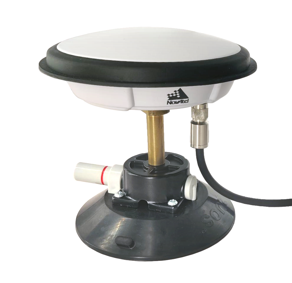
The ANavS® Multi-Sensor (MS-) RTK/PPP module provides precise position, velocity and attitude information. It is a turnkey system with a very attractive price/performance ratio and can be easily integrated into your application. It is widely used in the automotive, robotics, maritime, railway and mining industry, and of course also for surveying.
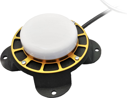
The ANavS® MS-RTK/PPP module includes up to 3 Multi-frequency, Multi-GNSS (GPS + Galileo + Glonass + Beidou) receivers, MEMS IMUs (industrial-grade, mid-grade, high-grade), a barometer, a CAN interface for reception of vehicle data (wheel odometry and steering angle), an LTE module for reception of RTK/ PPP corrections (e.g. from ANavS® RTCM reference station), and the powerful ANavS® Sensor Fusion on a single board. The latter one performs a tight coupling of all sensor data with an Extended Kalman Filter (EKF).

The ANavS® MS-RTK/ PPP module has various interfaces (e.g. Ethernet, USB, WiFi) that could be used for the connection of additional sensors, e.g. a camera or Lidar, or for outputting the position information. Prior position and attitude information e.g. from an external Simultaneous Localization and Mapping (SLAM) could be used by the ANavS® MS-RTK/ PPP module.

Centimeter Positioning Accuracy
- Precise absolute RTK positioning:
horizontal accuracy:
sigma = 1.0 cm
vertical accuracy:
sigma = 2.0 cm - Precise absolute PPP positioning:
horizontal accuracy:
sigma = 15 cm
vertical accuracy:
sigma = 20 cm - Precise absolute attitude (heading, pitch, roll):
sigma = 0.25° for 1 m distance
between the GNSS antennas

Multi-GNSS, Multi Frequency RTK/PPP Technology
- GPS (L1C/A, L1C, L1PY, L2C, L2P, L5)
- Galileo (E1, E5a, E5b, E5 AltBoc, E6)
- GLONASS (L1CA, L2CA, L2P, L3)
- Beidou (B1I, B1C, B2a, B2I, B3)
- QZSS (L1C/A, L1C, L2C, L5, L6)
- SBAS (Egnos, WAAS, GAGAN, MSAS, SDCM (L1, L5))
- On module L-band

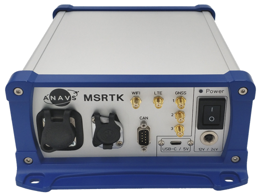
Easy system integration
Power supply:
- USB-C 5V
- Terminal connector: up to 36V
Solution output:
- Standardized NMEA format
- Proprietary ANavS binary format
- ACOM format (compatible with OxTS NCOM format)
- ROS support
Processor:
- Powerful Cortex-A72 64-bit Quad-Core with 1.5GHz
- Linux-OS for flexibiltiy

Breakthrough price


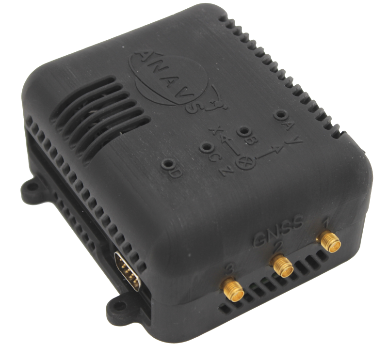
Low Size, Weight and Power consumption (SWaP)
- Dimension:
110mm x 80mm x 30 mm - Weight: 50g
- Power Consumption:
Peak: 15W (3A)
Average: 6.5W (1.3A)

Numerous interfaces
- Ethernet
- WLAN
- USB
- CAN
- LTE (with VPN remote-access)
The ANavS® MS-RTK/PPP module supports both Real-Time Kinematics (RTK) and Precise Point Positioning (PPP). RTK positioning uses measurements from a terrestrial reference station (e.g. ANavS® RTCM reference station) that are sent to the MS-RTK module via internet or long-range UHF modem. PPP uses satellite position, clock offset, phase and code bias corrections that are sent via internet or directly via satellite (using Galileo’s High Accuracy Service, HAS). The RTK positioning typically provides a higher positioning accuracy and faster convergence than PPP, but requires at least a partial internet coverage of your target application region and proper reference station infrastructure.
Both RTK and PPP include an advanced GNSS signal processing. A detailed mathematical description of RTK positioning can be found here and for PPP here. The ANavS® Sensor Fusion is ready to use the Galileo HAS corrections for its Multi-Sensor PPP solution. The MS-RTK/PPP module supports both positioning approaches with the same set of integrated sensors. No additional hardware is required and changes only affect the configuration, meaning that the MS-RTK/PPP module can serve as a single hardware platform for the Sensor Fusion no matter if the position is determined using RTK or PPP.
The MS-RTK/PPP module is designed for a fast prototyping and product integration (OEM-board) and can directly be used after connecting the GNSS antennas. You can choose between an industrial casing and a printed light one for all applications where weight is a key requirement.
Tell us more about your application and how we can be part of improvements. We encourage you to send us your questions and special requests about the MS-RTK/PPP and the ANavS® Sensor Fusion. Together we can find the perfect solution for your needs.
Datasheets
Why should I use the ANavS® MSRTK?
- The patented ANavS® tightly coupled sensor fusion provides real-time 3D-position, 3D-attitude (heading, pitch, roll), 3D-velocity and 3D acceleration information with an update-rate of up to 120 Hz.
- Temporary GNSS outages (in narrow street canyons, below bridges, in garages or tunnels) or high multipath (e.g. below trees) are overcome by the integration of additional sensors (IMU, wheel odometry, camera, LiDAR or UWB-based Local Positioning Systems (LPS)/ Real-Time Locating Systems (RTLS). Thereby, precise position and attitude information is still provided in challenging environments.
- We can flexibly configure the ANavS® Multi-Sensor RTK module according to your needs: You can choose between one, two and three integrated GNSS receivers. If you are interested only in an accurate position, then one integrated GNSS receiver is totally sufficient. If you also need an accurate heading, you should have two integrated GNSS receivers. If you need a full 3D attitude information (heading, pitch and roll), then you should choose the version with three integrated GNSS receivers. The use of 3 instead of 1 or 2 GNSS receivers also improves the positioning accuracy for mainly two reasons: First, a precise attitude information enables a much more accurate correction of the gravity and, thereby, improves the benefit of the inertial sensor within the sensor fusion. Second, the number of GNSS measurements increases with the number of GNSS receivers, and thereby, enables a more stringent selection of the best GNSS observations. This leads again to a higher positioning accuracy.